Summary
The UFDP is located on the north rim of Cedar Breaks National Monument, with the plot center at 37.66° N, 112.85° W. Elevation ranges between 3039 m and 3169 m for a vertical relief of 130 m (Fig. 2).
The parking area for the Rattlesnake Trailhead is about 1,000 m east of the UFDP. There is a meteorological station and a Utah Department of Transportation webcam there. If the webcam is running, the leftmost image shows current conditions. Otherwise, a selection of archived images is to the right.
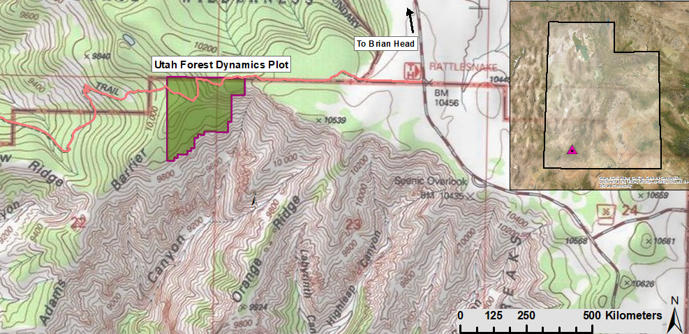
Figure 1. Location of the Utah Forest Dynamics Plot. The plot is on the north boundary of Cedar Breaks National Monument, 1 km west of SR 143 along the Rattlesnake Trail. The associated 7.5 minute USGS quadrangle is Brian Head.
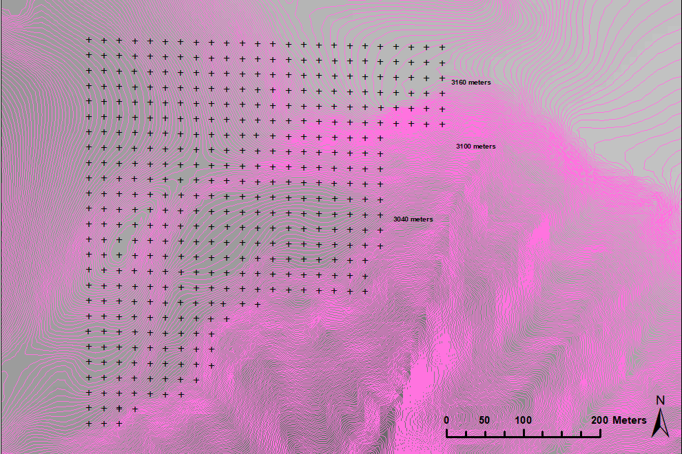
Figure 2. Topography of the Utah Forest Dynamics Plot. The displayed 20 m grid was installed using Total Stations and survey-grade Global Positioning System equipment during 2014 and 2015. The 90% confidence interval on the location of the grid points to the datum (NAD83) is less than 0.02 m, with primary monuments located to better than 0.004 m. Elevation shown here is from a USGS digital elevation model (10 meter horizontal resolution). Dark lines are 5 meter contours, light lines are 1 meter contours.
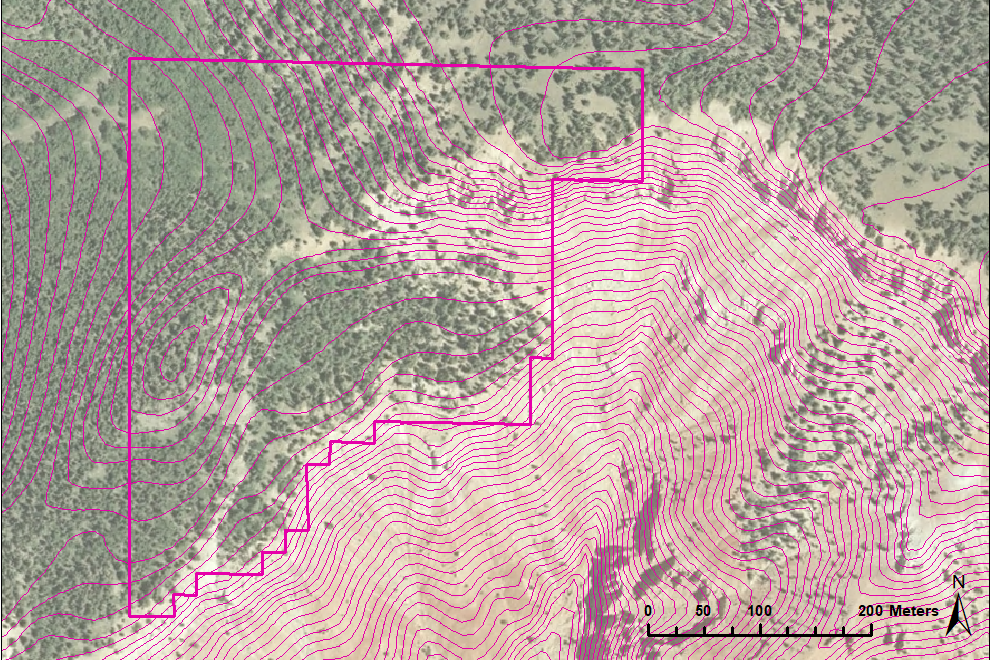
Figure 3. Orthophoto of the Utah Forest Dynamics Plot. Study site boundary and 5 meter contour lines superimposed on the image.
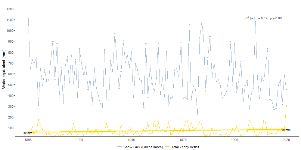
Figure 4. Temperature and precipitation in the Utah Forest Dynamics plot (top) from PRISM 800 m climate normals (1981-2010) and the water balance (bottom) using a Thornthwaite-type evapotranspiration model.
All stems
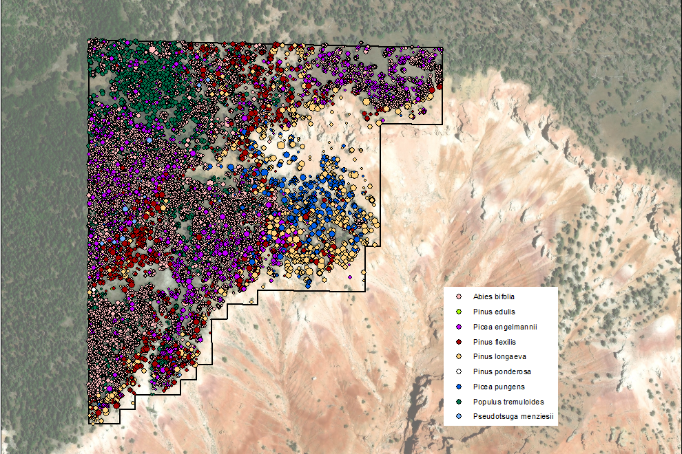
Figure 5. Every woody stem (live or dead) ≥1 cm diameter at breast height (DBH, 1.37 m) is tagged (22,482 live trees and 4,009 snags in 2015). Mortality surveys are conducted annually, factors associated with death are identified for all newly dead trees, and ingrowth trees are tagged. Diameter is remeasured every 5 years.
Seedlings
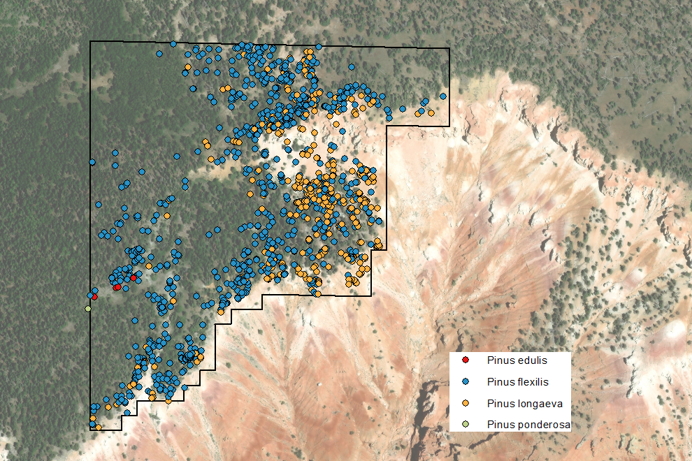
Figure 6. All Pinus seedlings at least two years old are tagged (1,266 seedlings) and mapped.
Coarse woody debris
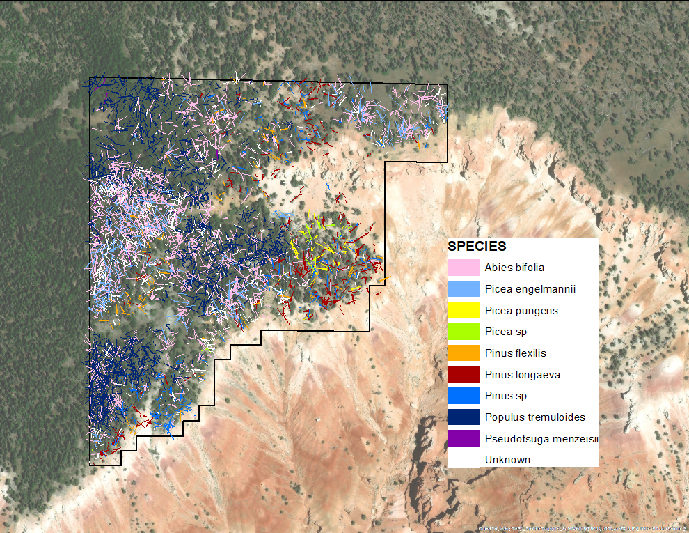
Figure 7. All down woody debris with large end ≥10 cm diameter from main stems, mostly identified to species.
Fugal associations
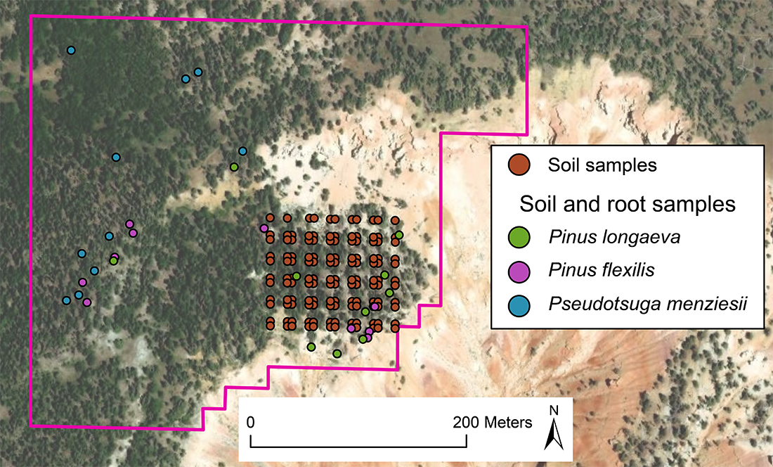
Figure 8. Mycorrhiza. We sampled soil on a grid and paired soil-root locations for three species. In all cases the ITS2 region was amplified.
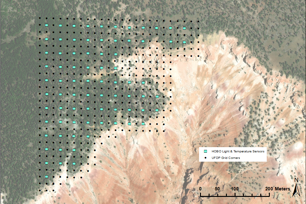
Figure 9. Locations of 78 main grid data logging temperature and light sensor (Onset HOBO logger).
Woody Plant Species
| Tree Species | Family |
| Abies bifolia | Pinaceae |
| Abies concolor | Pinaceae |
| Juniperus scopulorum | Cupressaceae |
| Picea engelmannii | Pinaceae |
| Picea pungens | Pinaceae |
| Pinus edulis | Pinaceae |
| Pinus flexilis | Pinaceae |
| Pinus longaeva | Pinaceae |
| Pinus ponderosa | Pinaceae |
| Populus tremuloides | Salicaceae |
| Pseudotsuga menziesii | Pinaceae |
| Shrub Species | Family |
| Amelanchier alnifolia | Rosaceae |
| Cercocarpus ledifolius | Rosaceae |
| Juniperus communis | Cupressaceae |
| Ribes cereum | Grossulariaceae |
| Ribes montiginum | Grossulariaceae |
| Sambucus racemosa | Adoxaceae |